On this page we are assembling images of interest around the High Bridge, Highbridge Park and the Highbridge Park neighborhood which is located at the Harlem River in upper Manhattan and the Bronx. The High Bridge connects the Manhattan Washington Heights neighborhood to the Highbridge neighborhood in the Bronx. If you want to contribute to this page just send us the image.
You may also be interested in seeing the
High Bridge in Art page that we have assembled.
 |
| From Highbridge Park south of the bridge, 1909 |
 |
| The High Bridge as seen from the north looking toward the south along the walkway/ bicycle path along the Harlem river. The Alexander Hamilton Bridge can be seen above. The original stone arches of the High Bridge can be seen on the Bronx side of the bridge. The 1928 steel span modification crosses the river. |
 |
| High Bridge 1919 (provided by Matthew Malina) |
 |
| High Bridge Gatehouse (provided by Matthew Malina) |
 |
| The High Bridge as seen from the southern side in the Bronx viewing the Highbridge Park in Manhattan (Washington Heights). You can see the Highbridge Park Tower at the terminus of the High Bridge. Also visible in this image is the Harlem River Drive (lowest road) and the entrance ramp for I-95 to/from the Harlam River Drive (sloping down to the left). |
 |
The High Bridge as seen from Highbridge Park slightly south of the bridge looking toward The Bronx.
The Harlem River and the Harlem River Drive can be seen below The Major Deegan Expressway can be seen on the other side of the river. (Photo courtesy Erasmo Corniel) |
 |
| Atop The High Bridge 2012 (prior to redevelopment) |
 |
| The High Bridge as seen from High Bridge Park viewed looking toward The Bronx |
 |
A Great Shot of the High Bridge from the Bronx.
This picture was taken in 1890 after the Water Tower was built (1860s) and before
the central steel span was built (1927)
|
 |
This postcard of The High Bridge taken from The Bronx probably dates to the 1910's.
The existence of the Washington Bridge puts it after the turn of the century.
The arches in the river without the steel span puts it before the 1920's.
The buildings along amsterdam Ave behind the Water Tower put it after about 1915.
Do you see any other clues? |
 |
Stereo Photograph taken apparently during the construction of the New Croton Aqueduct in the 1860s.
The new tube can be seen exposed on the deck of the bridge. |
 |
View from Highbridge Park toward the Bronx across the Harlem River just below The High Bridge. The prominent building in the picture still stands today and is used as a local precinct for the NYC Police Department.
Picture by Charles Wager Hull, 1864 |
 |
Cabinet Photo, photographer unknown ca. 1880.
View of High Bridge from the South looking Northeast at the Bronx side. |
 |
| Photo image of Washington Bridge and The High Bridge over the Harlem River taken from north of the Washington Bridge on the Manhattan side, c. 1890 |
 |
| A very rare aerial photograph of The High Bridge and Washington Bridge taken from south of the High Bridge looking northerly, c.1922 |
 |
View of The High Bridge, NY 1861. Drawn from nature & lithographed by George Hayward for D. T. Valentine's Manual, 1862. Note that the large tube for the New Croton Aqueduct is clearly visible during the construction.
See the additional print below. |
 |
| Photo taken from the south of the High Bridge in Highbridge Park around 1919 |
This is a WNET Channel 13
documentary video on the High Bridge done in 2011.
 |
| Courtesy The New York Historical Society. c. 1861 |
See: http://nyhistory.tumblr.com/post/67107070012/november-15-1848-high-bridge-aqueduct-built-to
 |
| Courtesy The New York Historical Society |
 |
| Courtesy The New York Historical Society |
 |
| Photographer Unknown |
 |
| Sketch, c. 1900, from Washington Bridge looking south. |
 |
| High Bridge Pumping Station |
 |
| Harper's New Monthly Magazine, 1861. New York Circumnavigated by T Addison Richards |
This one from the 1920s appeared in the New York Times in 2010.
 |
| Add caption |
 |
Airplane View of NY City High Bridge and Washington Bridge (date unknown)
American Museum of Natural History |
|
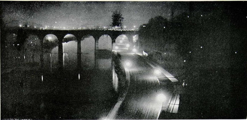
Copyright 1973 David Plowden
Image located at the Yale Collection of Western Americana, Beinecke Rare Book and Manuscript Library
New Haven, CT |
 |
Stereoview "Kyle's Dock near High Bridge, Harlem New York"
|
|
Stereoview "The Stupendous Croton Aqueduct" High Bridge Harlem, NY Roman arches"
|
 |
| Stereoview "Sunday Stroll, High Bridge, NY" |
 |
1895 Photo of the Polo Grounds with Coogan's Bluff in the background. You can see the Morris-Jumel home.
On the far right on the Bluff you can see the High Bridge water tower and the final arches of the Aqueduct Bridge as
it arrives in Manhattan from the Bronx
|
 |
Photograph appeared in Engineering News-Record, 1927, during construction
for the new steel span to replace the piers in the Harlem River |
 |
View of the water main in 1927 during alteration of High Bridge.
Photo: Eugene de Salignac, NYC Municipal Archives |
Here is a location online maintained by the New York Public Library with many of these images and many others.
Thanks to Steven Kehoe for finding this
link to the NYC Department of Records showing the reconstruction of the High Bridge central span with steel in 1927.
 |
| July 27, 1927 |
 |
| Grand Stairway, High Bridge (Bronx Side) |
 |
| Sedgwick Ave. looking south toward High Bridge, Bronx, circa 1895 |
 |
| New York Central Railroad -- First stop at High Bridge Station, 1908 |
 |
| Harlem River Speedway Course, looking south, towards the High Bridge. Picture from Port of New York Authority, courtesy Museum of the City of New York. |
 |
| Harlem River View from High Bridge |
 |
Photo view from the south of High Bridge looking north at the Speedway
1905 |
.jpeg)
High Bridge from the East
Stereoview of construction of the New Croton Aqueduct 1869(?)
last modified 11/04/2020


.jpeg)
